
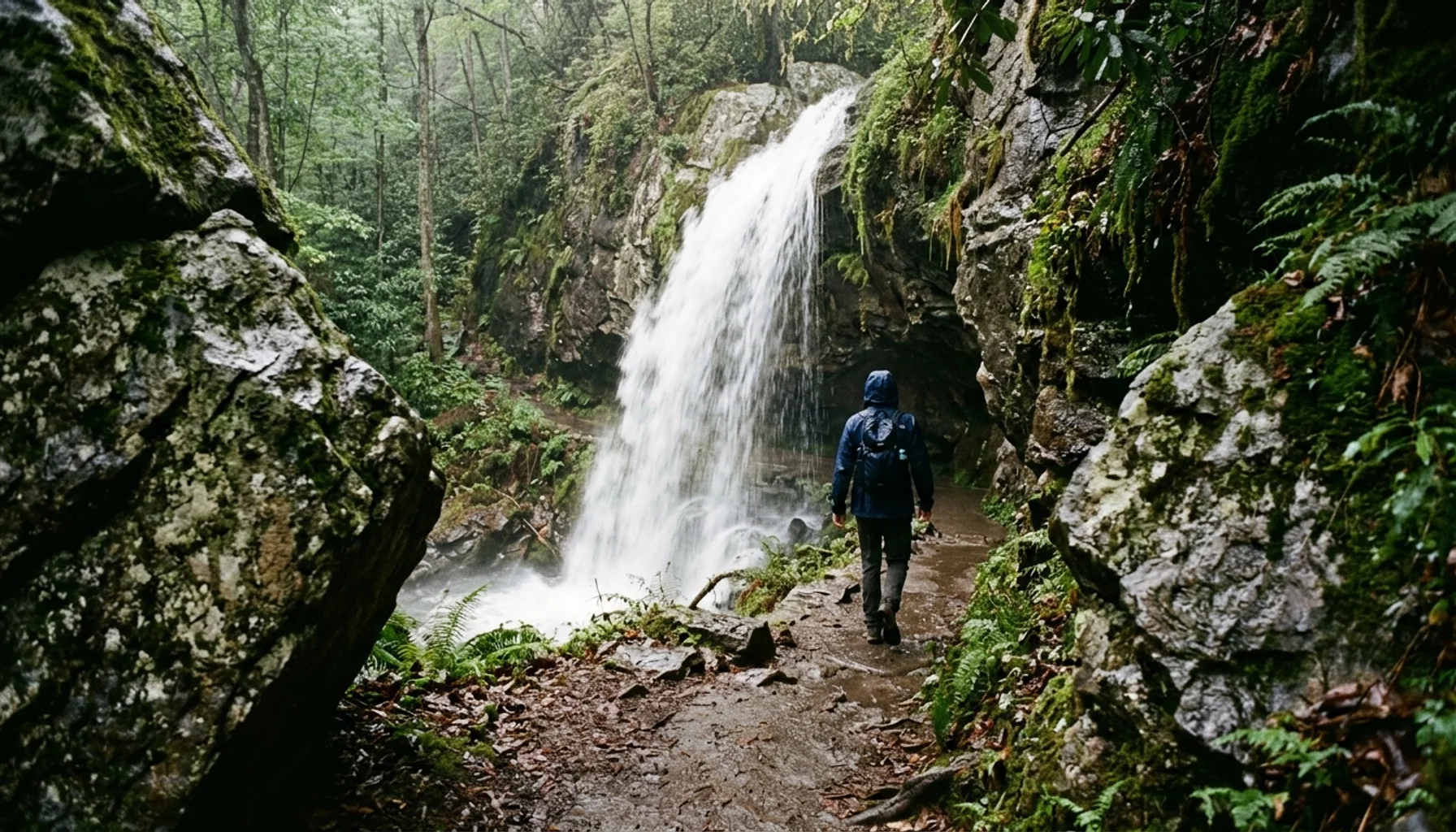
The best hikes near Gatlinburg range from the 1.6-mile round trip to Grotto Falls, an easy family walk that passes behind a waterfall, to the strenuous 11-mile round trip up Mt. LeConte via Alum Cave Trail, which climbs more than 2,700 feet to one of the highest summits in the Great Smoky Mountains National Park. Between those two extremes sit moderate options like Laurel Falls and Rainbow Falls that reward a couple hours of effort with genuine waterfall payoff. Great Smoky Mountains National Park logged 11.5 million visits in 2026, according to National Park Service visitation reports, and roughly 62% of those visitors passed through Gatlinburg during their trip.
Key Takeaways
- Grotto Falls is the only trail in the Great Smoky Mountains where you can walk behind a waterfall, and at 1.6 miles round trip it works for most kids over age five.
- Alum Cave Trail to Mt. LeConte covers roughly 11 miles round trip with over 2,700 feet of elevation gain, making it the toughest full-day hike on this list.
- Laurel Falls is paved for its first mile but still classified as moderate by the National Park Service because of steep drop-offs near the falls.
- Fall foliage season (October) sees the heaviest trail traffic and the fullest trailhead parking lots of the year, based on regional tourism data showing October as Gatlinburg’s peak visitation month.
- Summit View Lodge sits 4 miles from the national park entrance in Chalet Village North, putting most trailheads on this list within a 20 to 40 minute drive.
- Sevier County tourism, which includes Gatlinburg, generated $3.93 billion in visitor spending in 2026, much of it tied to park-based recreation like hiking.
If you’ve typed “best hikes near Gatlinburg” into a search bar, you’re probably staring down a trip with mismatched fitness levels, a tight weekend window, or both. Maybe you’ve got a toddler who can manage a mile but not five, or a hiking partner who wants a summit view and doesn’t care how much it burns. That’s the actual planning problem, and most trail guides don’t solve it.
This ranking sorts ten trails by two things that matter more than trail name recognition: how hard the hike actually is, and whether the view at the end justifies the effort. Some entries here are famous for good reason. Others get overlooked because they don’t photograph as well as Chimney Tops used to, before storm damage closed sections of that trail. All of them sit within a reasonable drive of downtown Gatlinburg and the park’s main entrance.
We’ve hiked these trails ourselves and hosted enough Summit View Lodge guests coming back from them, muddy boots and all, to know which ones live up to the hype and which ones don’t. Expect honest difficulty ratings, real mileage, and the kind of parking and timing advice that keeps a good hike from turning into a bad afternoon in 2026.
What Is the Most Scenic Hike in the Smoky Mountains?
The most scenic hike in the Smoky Mountains, by most measures of view-to-effort ratio, is the Alum Cave Trail to Mt. LeConte, which climbs to a summit 233 feet below Clingmans Dome, the park’s highest peak, according to published elevation data. The trail delivers dramatic rock formations, a natural stone arch, and a 360-degree panorama from LeConte Lodge’s Cliff Tops overlook.
Specifically, the first 2.3 miles to Alum Cave Bluffs make a satisfying shorter hike on their own, passing through Arch Rock (a natural tunnel carved into the mountainside) and a narrow ledge with cable handholds. Continuing to the summit adds roughly 6 more miles round trip and significant elevation gain.
For a shorter scenic payoff, Clingmans Dome itself offers a half-mile paved but steep walk to a 54-foot observation tower with views into Great Smoky Mountains National Park stretching into North Carolina and Tennessee on clear days. As of 2026, this remains one of the most-visited single viewpoints in the park.
How Do the Best Hikes Near Gatlinburg Compare Side by Side?
Comparing the best hikes near Gatlinburg side by side means weighing round-trip distance, elevation gain, and what you actually see at the end, since a short trail with a waterfall can outperform a long trail with tree-covered views. The table below breaks down all ten hikes covered in this guide by difficulty, mileage, and the specific payoff waiting at the trailhead’s end.
| Trail | Round Trip Distance | Difficulty | View Payoff | Drive Time from Gatlinburg |
|---|---|---|---|---|
| Grotto Falls | 1.6 miles | Easy | Walk behind a waterfall | 20-25 min |
| Laurel Falls | 2.6 miles | Easy-Moderate | 80-foot cascading waterfall | 15-20 min |
| Cataract Falls | 1 mile | Easy | Small falls near town | 5 min |
| Rainbow Falls | 5.4 miles | Moderate | 80-foot single-drop falls | 15-20 min |
| Trillium Gap Trail | 7.4 miles to LeConte | Moderate-Strenuous | Falls plus summit option | 20-25 min |
| Baskins Creek Falls | 2.9 miles | Moderate | Secluded 35-foot falls | 10-15 min |
| Chimney Tops (viewpoint) | Varies by open section | Strenuous | Rock summit views | 10 min |
| Clingmans Dome | 1 mile | Easy-Moderate | Highest point in the park | 50-60 min |
| Alum Cave to LeConte | 11 miles | Strenuous | 360-degree summit panorama | 15-20 min |
| Ramsey Cascades | 8 miles | Strenuous | Tallest waterfall in the park | 35-40 min |
Which Easy Hikes Near Gatlinburg Work Best for Families?
Easy hikes near Gatlinburg that work best for families are trails under 3 miles round trip with gentle elevation gain, and Grotto Falls tops that list because it’s the only trail in the entire national park where hikers can walk behind a waterfall. At 1.6 miles round trip with about 500 feet of gain spread evenly across the route, it suits most kids over age five and grandparents who want a real trail without a grueling climb.
The Grotto Falls trailhead sits along the Roaring Fork Motor Nature Trail, a one-way loop road that also passes historic log cabins from the park’s early homestead era. Start early, ideally before 9am, since the small gravel parking area fills quickly on weekends and during October’s peak foliage crowds.
Laurel Falls is the park’s most-hiked trail and for good reason: it’s paved for the full 2.6-mile round trip, making strollers technically possible, though the surface gets uneven and cracked in spots. The National Park Service still classifies it as moderate because of steep, unguarded drop-offs near the 80-foot falls, so keep young kids close on the final approach.
For families staying near Chalet Village North, Cataract Falls offers the shortest option on this list at just 1 mile round trip, accessible from the Sugarlands Visitor Center parking lot. It’s a modest cascade rather than a dramatic waterfall, but the flat, shaded path makes it a low-stakes warm-up hike for a first day in the mountains.
Is Grotto Falls or Laurel Falls Better?
Grotto Falls beats Laurel Falls for most hikers because it offers a rarer experience (walking behind the falls) with less crowding, while Laurel Falls wins on accessibility thanks to its fully paved surface. Both trails run under 3 miles round trip and rank among the most popular short hikes near Gatlinburg, but they solve different problems.
Specifically, Laurel Falls draws heavier crowds because of its proximity to Sugarlands Visitor Center and its paved path, which means parking lots often overflow by mid-morning on weekends. Grotto Falls requires driving the slower Roaring Fork Motor Nature Trail loop, which naturally filters out casual visitors and keeps the trail quieter.
As a result, if photography matters more than convenience, choose Grotto Falls. The mossy rock overhang behind the falls creates a naturally framed shot unavailable anywhere else in the park. If you’re pushing a stroller or traveling with someone who has mobility limitations, Laurel Falls’ paved surface, despite the steep final stretch, remains the more practical choice for 2026 trips.
What Moderate Hikes Near Gatlinburg Feature Waterfalls?
Moderate hikes near Gatlinburg featuring waterfalls include Rainbow Falls, Baskins Creek Falls, and the lower sections of Trillium Gap Trail, each running between 2.9 and 5.4 miles round trip with elevation gain steep enough to require real trail shoes. These trails suit hikers who’ve done a few day hikes before but aren’t training for a summit.
Rainbow Falls, at 5.4 miles round trip, climbs roughly 1,500 feet to reach an 80-foot single-drop waterfall, the tallest of its kind in the park. The trail gets its name because mist off the falls creates a visible rainbow on sunny afternoons, typically between 11am and 2pm when the sun angles directly into the spray.
Baskins Creek Falls is the trail most Gatlinburg guides skip entirely, and that’s the point. At 2.9 miles round trip with a 35-foot falls at the end, it draws a fraction of the traffic that Laurel Falls or Rainbow Falls see, even during October’s peak season. The unmarked trailhead near the Baskins Creek Cemetery on Roaring Fork Motor Nature Trail trips up first-timers, so watch for the small brown park sign rather than expecting a paved lot.
Trillium Gap Trail also passes Grotto Falls before continuing toward Mt. LeConte, making it a natural next step for hikers who did the easy version and want more mileage without committing to a full summit attempt.
What Strenuous Hikes Near Gatlinburg Lead to Mountain Summits?
Strenuous hikes near Gatlinburg leading to mountain summits include Alum Cave Trail to Mt. LeConte, Ramsey Cascades, and the remaining open sections of Chimney Tops, all requiring 6 or more hours round trip and elevation gain exceeding 2,000 feet. These trails demand real hiking boots, at least 2 to 3 liters of water per person, and an early start.
Alum Cave Trail is the shortest and most popular route to Mt. LeConte’s summit, covering about 11 miles round trip with roughly 2,700 feet of elevation gain. The trail passes Arch Rock, a tunnel-like rock formation, and Alum Cave Bluffs, a massive overhanging cliff face, before the final steep push to LeConte Lodge, the only backcountry lodge in the park accessible solely on foot.
Ramsey Cascades tops out at 100 feet, making it the tallest waterfall in the Great Smoky Mountains, but reaching it requires an 8-mile round trip over rocky, root-covered terrain with a rough final half-mile scramble. Budget 6 to 8 hours and skip this one after heavy rain, when the creek crossings become genuinely hazardous.
Chimney Tops has a complicated recent history: a 2016 wildfire and subsequent trail damage led the National Park Service to close the final summit scramble in past years. As of 2026, hikers should check current National Park Service trail conditions before attempting this one, since sections have opened and closed intermittently.
What Are the Four Worst Times to Visit Gatlinburg for Hiking?
The four worst times to hike near Gatlinburg are mid-October weekends during peak leaf season, any afternoon in July and August when thunderstorms roll in predictably by 2pm, the week between Christmas and New Year’s when trailhead parking overflows onto shoulders, and any day within 48 hours of heavy rain on trails with creek crossings.
October remains the single busiest month for Gatlinburg-area tourism, with regional short-term rental data showing occupancy spiking well above summer averages during peak foliage weeks. Trailhead lots at Laurel Falls and Grotto Falls routinely fill by 8am on October Saturdays, and roadside parking along Cherokee Orchard Road draws ticketing in some areas.
Summer afternoon thunderstorms are a genuine safety issue at elevation, not just an inconvenience. Exposed ridgelines near Mt. LeConte and Clingmans Dome see lightning risk climb sharply after 1pm from June through August, so plan summit attempts with early starts and firm turnaround times.
Winter brings its own complications. Snow and ice can make upper-elevation trails near LeConte genuinely dangerous without microspikes, and the mountain roads leading to trailheads get slick fast. If you’re driving up to Chalet Village North in winter, AWD or 4WD is worth having, since even well-maintained paved roads turn tricky after a snowfall.
How Should You Choose the Right Hike for Your Fitness Level?
Choosing the right hike near Gatlinburg starts with an honest assessment of your slowest group member’s fitness, not your own, since a mismatched trail ruins a day faster than bad weather. Match round-trip mileage and elevation gain to that person’s realistic capability, then build in a buffer.
Follow this general framework when picking from the ten trails above:
- Under 3 miles, minimal incline: Choose Grotto Falls, Cataract Falls, or the first half-mile of Laurel Falls if traveling with young kids, grandparents, or anyone recovering from injury.
- 3 to 6 miles, moderate incline: Choose Rainbow Falls or Baskins Creek Falls for hikers who walk regularly but don’t train specifically for elevation.
- 6 to 12 miles, steep incline: Choose Alum Cave Trail to LeConte or Ramsey Cascades only if the group hikes regularly and starts before 8am.
- Check current conditions first: Always verify trail status through the National Park Service before driving to trailheads for Chimney Tops or any trail near recent storm damage.
- Pack for elevation changes: Temperatures at Mt. LeConte’s summit run 10 to 20 degrees cooler than downtown Gatlinburg, so bring layers even in summer.
Common mistakes worth avoiding: starting a strenuous hike after 11am, assuming cell service will work for navigation past the first mile of most trails, and underestimating how much water a 10-mile hike with 2,700 feet of gain actually requires. Two to three liters per person is the realistic minimum for a full-day summit attempt.
Where Should You Stay to Access These Trails Easily?
The best home base for hiking near Gatlinburg is a cabin within a 20 to 30 minute drive of the national park entrance, since most trailheads on this list sit along Newfound Gap Road, Cherokee Orchard Road, or the Roaring Fork Motor Nature Trail loop. Location matters more here than in most vacation destinations because early starts beat crowds and afternoon thunderstorms alike.
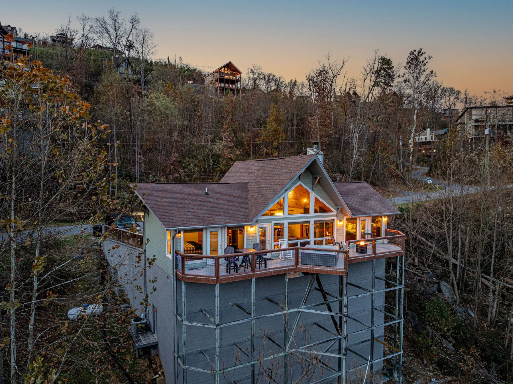
Summit View Lodge sits in Chalet Village North, just 4 miles from the national park entrance and 3 miles from downtown Gatlinburg, putting Grotto Falls, Rainbow Falls, and the Alum Cave trailhead all within a 20 to 25 minute drive. That proximity matters on hiking mornings when you want coffee, not a 45-minute commute, standing between you and the trailhead.
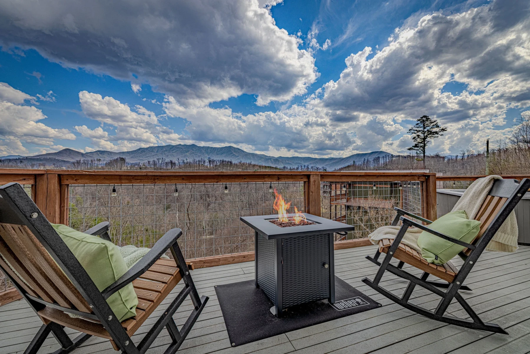
After a long day on Alum Cave Trail or Ramsey Cascades, the private hot tub on this cabin’s view deck earns its keep. The single-level layout with no interior stairs also helps when everyone’s legs are done climbing anything, including a flight of steps to bed.
For a broader look at what else fills a Smoky Mountains itinerary beyond the trailhead, see this guide to Gatlinburg things to do that skip the tourist traps, or plan a rest day with this roundup of best restaurants in Gatlinburg for groups and fussy eaters.
What Should You Skip When Hiking Near Gatlinburg?
Skip attempting Ramsey Cascades or Alum Cave Trail to LeConte’s summit as a first-day hike right after a long drive, since altitude adjustment and unfamiliar terrain add real risk to already-strenuous trails. Save the toughest hikes for day two or three once you’ve acclimated.
Also skip Chimney Tops entirely if current National Park Service alerts show closures past the lower junction; the scramble sections that made this trail famous have seen intermittent closures since 2016 storm damage, and hiking around barriers is both unsafe and against park regulations.
Skip parking illegally along Cherokee Orchard Road or Roaring Fork Motor Nature Trail during peak October weekends. Rangers do ticket vehicles parked on shoulders near Grotto Falls and Baskins Creek Falls trailheads when lots overflow, and towing does happen in the busiest weeks.
Finally, skip treating any of these trails as casually as a city park walk. Sudden weather changes, limited cell service, and genuine elevation gain mean even Laurel Falls has resulted in rescue calls for underprepared hikers. Tell someone your planned route and expected return time, especially for the longer trails.
Frequently Asked Questions
What is the easiest hike near Gatlinburg with a real payoff?
Grotto Falls is the easiest hike near Gatlinburg that still delivers a genuine payoff, since its 1.6-mile round trip lets hikers walk behind a waterfall, an experience unique to this trail within the national park. Cataract Falls is shorter at 1 mile but offers a more modest cascade.
How far is Summit View Lodge from the national park entrance?
Summit View Lodge sits 4 miles from the Great Smoky Mountains National Park entrance and 3 miles from downtown Gatlinburg, placing most trailheads on this list within a 20 to 25 minute drive from the cabin in Chalet Village North.
Do I need a permit to hike near Gatlinburg?
Day hiking on trails like Grotto Falls, Laurel Falls, Rainbow Falls, and Alum Cave Trail does not require a permit, but overnight backcountry camping within Great Smoky Mountains National Park does require a permit through the National Park Service. Always check current requirements before an overnight trip.
What is the best time of year to hike near Gatlinburg?
Late spring (April through May) and early fall (September through early October) offer the most comfortable temperatures and fewer crowds than peak October foliage weeks or busy summer months. October brings the most dramatic scenery but also the heaviest trailhead traffic of the year.
Is Alum Cave Trail hard for beginners?
The first 2.3 miles of Alum Cave Trail to Alum Cave Bluffs is moderate and manageable for hikers with some trail experience, but continuing the full 11-mile round trip to Mt. LeConte’s summit involves over 2,700 feet of elevation gain and is not recommended for first-time hikers.
Are the Chalet Village pools available year-round for guests staying near these trails?
No, Chalet Village community pools are open seasonally, typically from Memorial Day through Labor Day, so guests hiking in the shoulder or winter season won’t have pool access but can still use the private hot tub at cabins like Summit View Lodge.
Should I book direct or through an OTA for a hiking-focused Gatlinburg trip?
Booking direct with the cabin’s owners often means more flexible check-in times for early trailhead starts and clearer communication about trail conditions or road access. For a full comparison, see this breakdown of booking direct versus Airbnb for a Gatlinburg cabin.
Conclusion
The best hikes near Gatlinburg cover a genuine range, from the 1.6-mile walk behind Grotto Falls to the 11-mile summit push up Mt. LeConte via Alum Cave Trail, and the right pick depends entirely on your group’s fitness and how much elevation gain everyone actually wants to sign up for. Start easy on day one, save Ramsey Cascades or Alum Cave for a day you’re rested, and always check current park conditions before chasing Chimney Tops.
With Great Smoky Mountains National Park drawing 11.5 million visits in 2026 and Sevier County tourism continuing to grow into 2026, these trails aren’t getting any quieter. Plan an early start, especially in October, and treat trailhead parking as first-come, first-served, because it is.
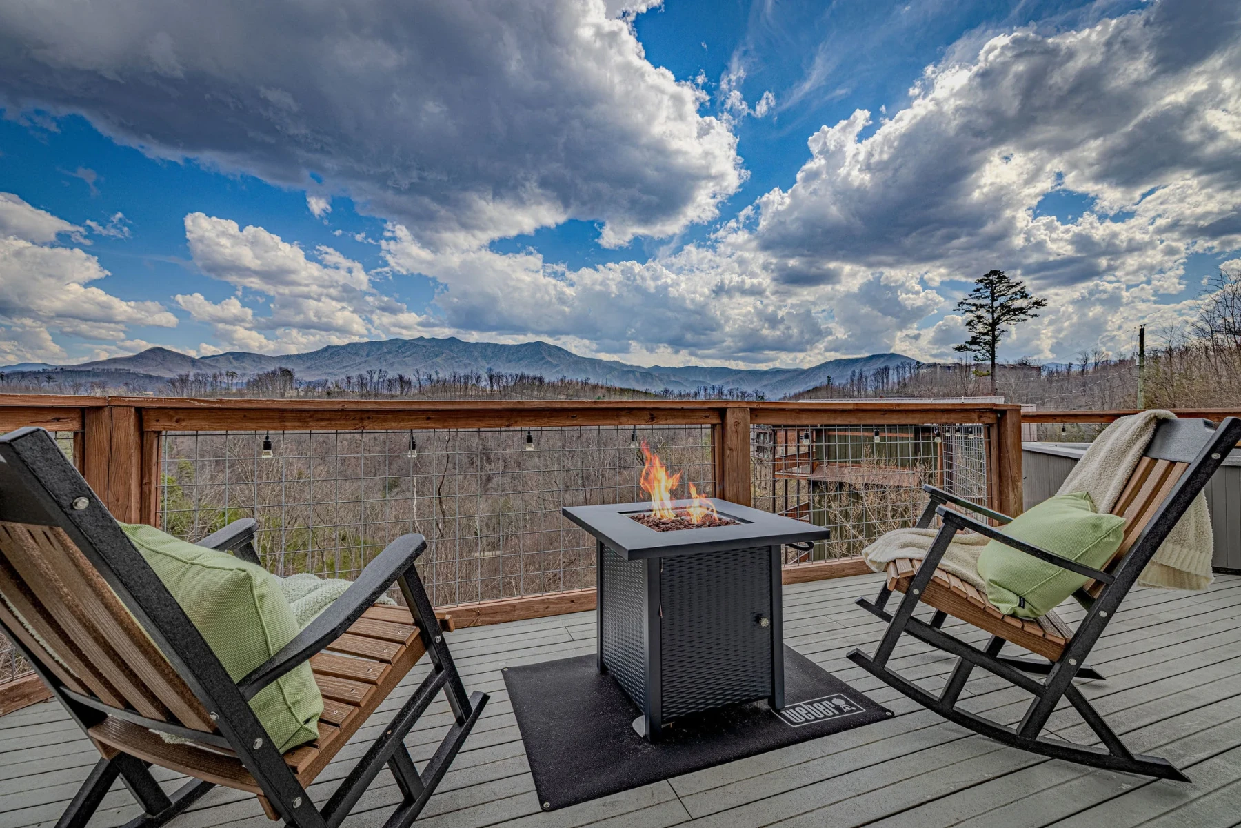
If you’re building a trip around trails like these, Summit View Lodge puts you about 20 to 25 minutes from most trailheads on this list, with a fire pit deck that’s hard to beat for comparing notes after a long day on Alum Cave Trail. Check availability at Summit View Lodge.